
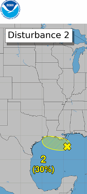
 Tropical Development Chances Increase to 30% for Invest 97L — Increased Rain Chances for SE Texas
The National Hurricane Center is now giving the area of disturbed weather in the Gulf a 30% chance of tropical development, up from previous outlooks.
For Southeast Texas, the bigger story may be the potential increase in moisture and rainfall rather than tropical development itself. 
Current precipitable water values are around 1.4–1.6 inches across the region — not particularly high for late August. However, a weak area of low pressure and an upper-level trough over the northern Gulf is expected to drift westward toward the western Gulf Tuesday into Wednesday.
As the system approaches, moisture levels should increase, potentially bringing much-needed rain chances to Southeast Texas, especially Tuesday and Wednesday. While conditions are not currently considered especially favorable for significant tropical development, they aren’t completely hostile either.
 Monday: Mainly isolated afternoon showers/storms, driven by the sea breeze and bay breeze. Tuesday–Wednesday: Increasing moisture and better rain chances as the Gulf disturbance moves closer. Late week: More seasonable conditions with daily chances for typical afternoon showers and thunderstorms. Bottom line: Don’t focus solely on the 30% development chance. For Southeast Texas, the potential for increased rainfall Tuesday–Wednesday could be the more meaningful impact. Residents should continue monitoring the latest forecasts, as the track, rainfall potential, and development chances could change.