
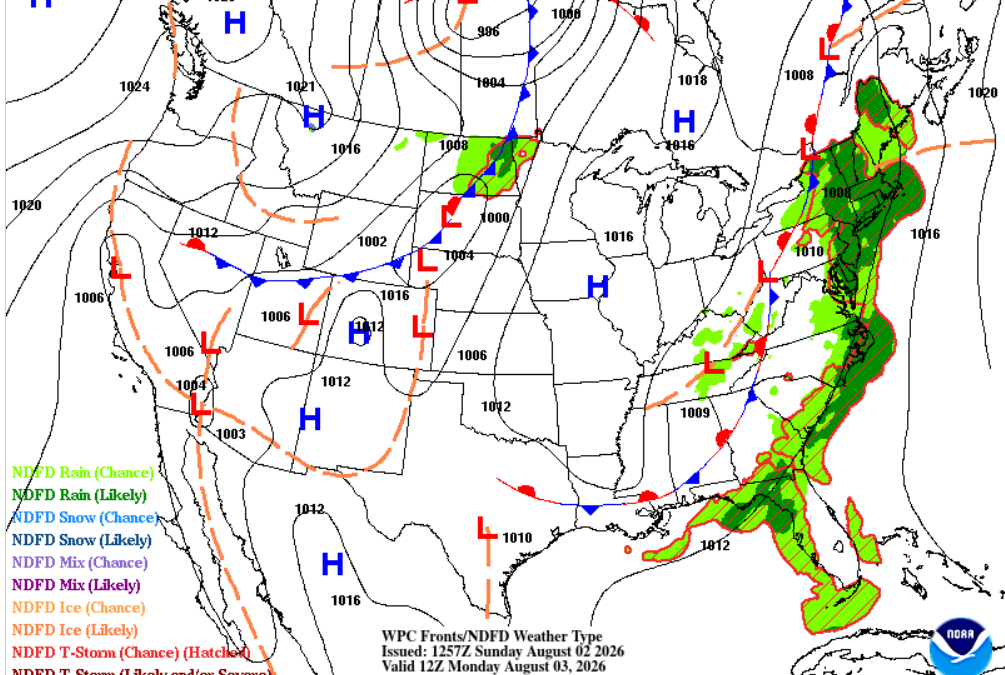
Heat Dominates Southeast Texas While the Ridge Gradually Weakens
The first week of August will feature a classic midsummer weather pattern across Southeast Texas, driven primarily by a strong subtropical ridge centered over the southern Plains and extending eastward across much of the Gulf Coast. This upper-level high will be the dominant weather feature through the first half of the week, suppressing widespread thunderstorm development while allowing temperatures to soar into the upper 90s and near 100 degrees.
Under the ridge, sinking air—or subsidence—continues to warm and dry the middle levels of the atmosphere. This creates what meteorologists often refer to as a “cap,” limiting vertical thunderstorm growth despite abundant Gulf moisture near the surface. While isolated sea breeze showers cannot be ruled out, rainfall coverage through Wednesday should remain sparse, with many locations staying completely dry.
Surface winds will remain out of the south to southeast throughout the week, maintaining a steady flow of warm, humid air inland from the Gulf. Overnight temperatures will only fall into the upper 70s, providing little relief from the daytime heat. Combined with dew points in the middle to upper 70s, afternoon heat index values will frequently climb into the 105 to 110 degree range, making heat safety a primary concern.
Why Rain Chances Increase Later This Week
By the second half of the week, forecast guidance indicates the upper ridge will begin to flatten and shift westward toward New Mexico and West Texas. While the ridge will not disappear, its influence over Southeast Texas will weaken enough to allow subtle disturbances moving around its eastern edge to approach the region.
At the same time, precipitable water values are expected to gradually increase as deeper Gulf moisture returns. This combination of increased moisture and a weaker cap should allow the afternoon sea breeze to become more effective at producing scattered showers and thunderstorms beginning Thursday and continuing into the weekend.
Even then, this does not appear to be a widespread rain event. Rather, Southeast Texas will transition back toward a more typical August pattern where scattered, locally driven thunderstorms develop during the afternoon and early evening. Rainfall will be highly variable, with some neighborhoods receiving brief heavy downpours while others remain dry.
Tropical Atlantic Remains Quiet
Across the Gulf of America and the tropical Atlantic, no significant tropical systems are expected to influence Southeast Texas this week. The dominant ridge over the southern United States also tends to steer any weak disturbances well away from the Texas coast while suppressing tropical development closer to home.
As always during hurricane season, conditions across the tropics will continue to be monitored, but the focus for Southeast Texas this week remains squarely on the heat.
Bottom Line
The overall weather pattern will be slow to change through the week. Expect dangerous afternoon heat through Wednesday with highs near 100°F and heat index values exceeding 105°F. By Thursday and Friday, a gradual weakening of the upper ridge will allow isolated to scattered afternoon thunderstorms to return, offering some localized relief—but not an end to the summer heat.
For anyone with outdoor plans, the greatest weather hazard this week will be prolonged heat exposure rather than severe weather or flooding.
Stay weather-aware and continue practicing heat safety by staying hydrated, taking frequent breaks outdoors, and checking on vulnerable family members and neighbors.
#WeatherInsights #HoustonWeather #SoutheastTexas #TexasWeather #TXwx #HeatSafety #SummerWeather #Meteorology #SynopticWeather #Houston