Blog
Flash flooding and river flooding ongoing in the TX Hill Country from overnight rains
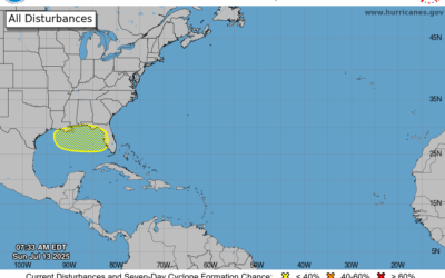
Low end chance of tropical development in the northern Gulf mid to late week. Heavy rainfall has once again impacted a large part of the TX Hill Country overnight and this morning with rainfall totals of 2-6 inches and isolated amounts of over 10 inches. This has once...
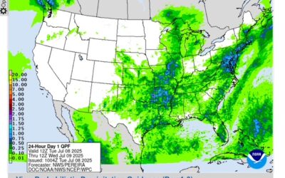
Drier weather for central Texas and the Hill Country; Wet weather pattern develops over SE TX through much of the week
Drier weather for central Texas and the Hill Country Wet weather pattern develops over SE TX through much of the week For the first time in a days the radars over central Texas and the Hill Country are showing no showers and thunderstorms this morning. Additionally,...
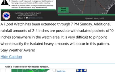
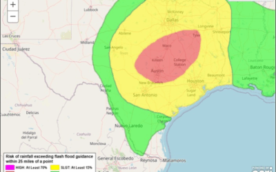
TX Flood Update (Sun AM)
No new flash flooding overnight Weather pattern remains in place today into Monday for additional heavy rainfall and flash flooding Persons should continue to be mindful of the weather conditions while visiting, camping, and vacationing in this area through tomorrow....
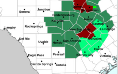
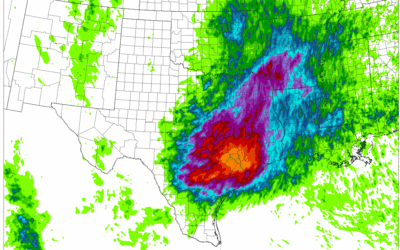
7-5-25: Catastrophic flash flood event ongoing northwest of Austin TX
Rainfall overnight of 10-15 inches including 10.50 inches at Lago Vista and 16.72 inches at Burnet TX with radar estimates of 20.07 inches in southern Burnet County is resulting in ongoing catastrophic flash flooding in much of Burnet and NW Travis Counties. Normally...
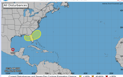
Tropical Depression 2 and NE Gulf (6-29-25)
Tropical depression #2 will move inland over eastern Mexico later today Increased rain chances today and Monday for the area Low end chance of tropical development late this week over the NE Gulf into the Atlantic Tropical Depression #2: A USAF mission investigating...
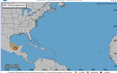
91L: Southern Gulf (6.28.25)
Short lived tropical depression/storm increasing likely later today/Sunday over the southern Gulf Plume of tropical moisture associated with this feature will bring increased rain chances Sunday and possibly Monday. Early morning visible satellite images and...
Heavy Rainfall Update (6-12-25 300am)
Heavy rainfall event underway over the region Numerous clusters of thunderstorms producing heavy rainfall developing along and west of I-45. Flash Flood Watch has been expanded to all counties. Increasing lift spreading across a very moist air mass has resulted in the...
Heavy Rainfall Threat (6-11-25) PM
Heavy rainfall and flash flooding possible tonight into Thursday mainly northwest of the Houston metro area Monitor heavy rainfall trends tonight into early Thursday for any shifts southward in the forecast A complex forecast for tonight into early Thursday as...
Active Weather (June 9, 25)
Stretch of active weather for the area through much of this week. While severe thunderstorm chances are low they are not zero. Heavy rainfall possible each day. Mid level high pressure that brought the hot and dry conditions since last Friday has...