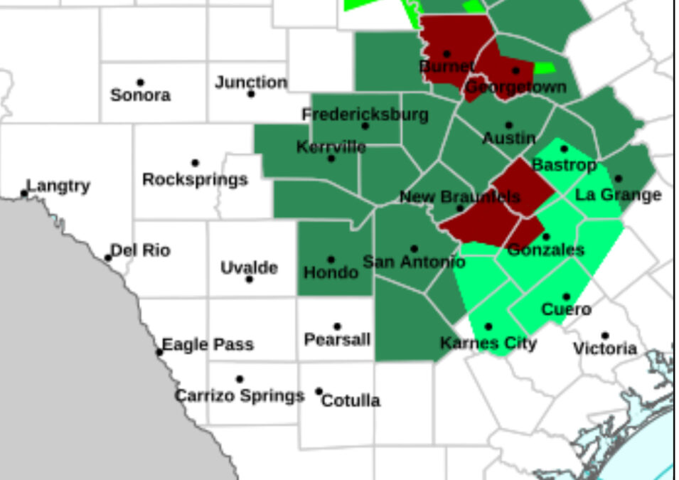
Rainfall overnight of 10-15 inches including 10.50 inches at Lago Vista and 16.72 inches at Burnet TX with radar estimates of 20.07 inches in southern Burnet County is resulting in ongoing catastrophic flash flooding in much of Burnet and NW Travis Counties. Normally dry creeks have risen over 30 feet this morning with numerous high water rescues in progress. Overnight rains along with major inflows form the Llano river have resulted in a rapid rise of Lake Travis by 10ft.
LCRA is actively in flood gate operations on Lakes LBJ and Inks passing upstream flows from the Llano River downstream. Lake Travis has significant capacity to absorb the incoming flood flows along with a large flood pool storage above its normal conservation level. However dangerous flows and currents along with significant floating debris will make these lakes dangerous through the weekend. Currently no flood gate releases downstream of Lakes Travis and Canyon are expected with the incoming flood flows as these lakes were significantly below conservation pools due to long term drought.
Mid level trough axis responsible for the catastrophic flooding yesterday in the Hunt to Kerrville area and this morning northwest of Austin is slowly meandering over central Texas in a highly tropical air mass. In fact overnight rainfall rates of 5.65 inches at Burnet and nearly 7.0 inches in NW Travis County show the capability of this air mass to produce devastating rainfall rates in short order. Rainfall recently has begun to focus southeast of the I-35 corridor from southeast of San Marcos to Lulling where radar is showing hourly rainfall rates of 4-5 inches in progress. Additional development today is possible along the highly populated I-35 corridor. Model guidance the last 2 nights has been pinging significant rainfall bullseyes with this system and unfortunately have verified. It is possible another episode may occur tonight, but guidance is not as aggressive as the last few nights, but there is some signal again for areas between Austin and Waco.
Guadalupe Flood Disaster:
Search and rescue effort have continued through the night along the upper Guadalupe River which saw catastrophic flooding yesterday morning. Multiple locations from upstream of Hunt TX to Kerrville remain inaccessible by vehicle due to heavy infrastructure damage…in some instances entire roads and bridges have been destroyed and washed away along with hundreds of homes, cabins, and RV’s that were close to the river. This flood surpassed the July 1987 flood in this area becoming the second highest crest on record at both Hunt and Kerrville before both USGS gages were destroyed.
Jeff Lindner
