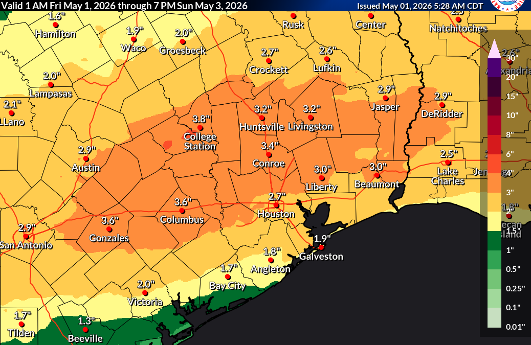
Heavy rainfall is ongoing this morning, primarily north of US-59, where a Flood Watch remains in effect. Early impacts are already being observed, including areas of street flooding and rising water levels along creeks and bayous—especially across the شمال and northwest portions of the Houston metro.
Overnight, thunderstorms produced pockets of large hail from Sugar Land to Pearland. While storm intensity has briefly decreased, the overall pattern remains active, and multiple rounds of showers and thunderstorms are expected to continue through the day. The axis of heaviest rainfall is currently aligned from Columbus through Sealy, Cypress, Kingwood, and Liberty. Additional rainfall totals of 1 to 3 inches are likely, with isolated areas potentially receiving 4 to 5 inches where storms repeatedly move over the same locations.
As rainfall continues and soils become increasingly saturated, runoff will intensify, leading to ongoing rises in creeks, bayous, and rivers. Although storm motions are relatively fast, the potential for training storms raises concern for localized flooding, particularly in more vulnerable watersheds.
There is also a limited severe weather risk. A few stronger storms today could produce large hail or gusty winds, especially if the coastal boundary shifts farther inland and enhances instability.
A strong cold front is expected to move through later today, bringing an end to the rain from north to south by this evening. In its wake, a much cooler and drier air mass will settle into the region, setting up a more pleasant and stable weather pattern for the weekend.
Podcast: Play in new window | Download
