Fairly complicated forecast over the next few days with an upper level trough moving across the state, a weak surface front lingering offshore into the area, and weak disturbances moving across the region. This all points to chances for showers and thunderstorms at about anytime over the next few days with chances highest when any disturbances approach from the southwest and west. One such disturbance is moving across the area this morning with scattered showers and thunderstorms ongoing mainly north of HWY 105. High resolution guidance has not really picked up on this activity well, but expect it to exit to the east through late morning with a break in activity into the afternoon hours…depending on your model of choice…some of the high resolution guidance shows additional showers and thunderstorms developing near the frontal boundary along the coast this afternoon…others do not.
Tonight a line or cluster of storms that forms over OK and N TX may make their way southward into the region around sunrise on Saturday. Some guidance shows this activity holding together while others show it weakening as it moves into the region. I am leaning more toward the weakening trends given the time of day, but this may leave some sort of outflow boundary in place for additional storms to form on Saturday afternoon with another disturbance or two riding up from the southwest.
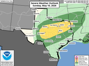
Into Sunday the next cool front will enter into N TX during the day and thunderstorms are likely to form along this boundary. Could see some sort of line or complex of storms form Sunday afternoon along the front and move into the area Sunday evening into Monday morning.
Severe:
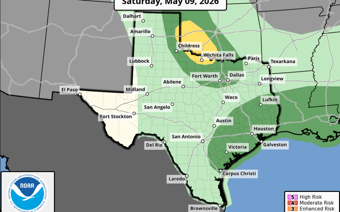
Overall the severe threat is not overly high through the period, but it is also not zero. “Marginal” or level 1 out of 5 risk is in place for northern and northeast areas today and for much of the region on Saturday. Isolated instances of large hail or damaging winds will be the primary threats.
Will need to keep an eye on Sunday evening as the next front approaches as it looks like we will have better instability to work with and severe thunderstorms could move into the area from the northwest.
Given the timing of various weak disturbances and generally weak features through the period…forecast uncertainty on timing and placement of any thunderstorms is higher than usual and the forecast will be subject to changes over the next few days.