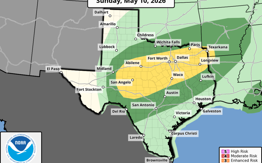
For Mother’s Day, Sunday the next cool front will enter into N TX during the day and thunderstorms are likely to form along this boundary. Could see some sort of line or complex of storms form Sunday afternoon along the front and move into the area Sunday evening into Monday morning.
Severe:
Overall the severe threat is not overly high through the period, but it is also not zero. “Marginal” or level 1 out of 5 risk is in place for northern and northeast areas today and for much of the region on Saturday. Isolated instances of large hail or damaging winds will be the primary threats.
Will need to keep an eye on Sunday evening as the next front approaches as it looks like we will have better instability to work with and severe thunderstorms could move into the area from the northwest.
Podcast: Play in new window | Download
