
Easter Forecast and Outlook
Weekend: Stronger front heads into the area late Saturday and expect a line of showers and thunderstorms to develop and cross the area Saturday afternoon and evening. Widespread moderate to at times heavy rainfall will be possible with this activity given the moisture...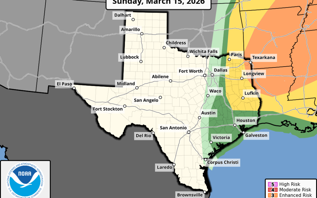
Strong cold front will sweep across the area Sunday evening
A few strong to severe thunderstorms will be possible along the front Strong northerly winds of 35-45mph will occur behind the front Sunday night into early Monday Frost possible Tuesday morning Tranquil weather today and much of Sunday will quickly change as...
A low end severe weather and excessive rainfall threat will evolve late Saturday into Sunday
Slow moving front will stall over the region this weekend \ There has been little change to the forecast thinking over the last 24 hours as a slow moving frontal boundary moves into the state and eventually stalls over SE TX Saturday afternoon into Sunday before...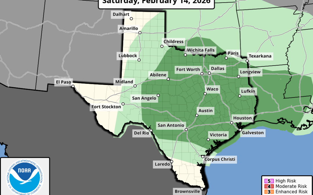
A storm system will move across Texas on Saturday
Widespread showers and thunderstorms are likely A few of the storms could become strong or severe in the late afternoon/evening An upper level trough a weak front will move across Texas on Saturday. Ahead of this feature an influx of Gulf moisture will surge into the...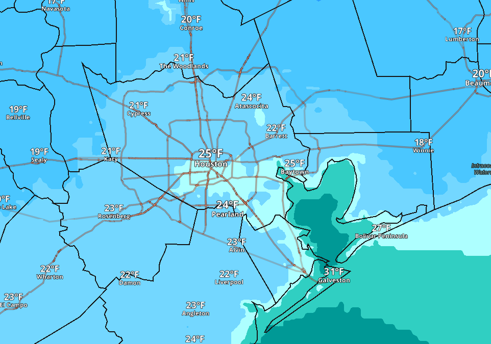
Cold Weather Advisory in effect for tonight into Saturday morning for low wind chills
Hard Freeze Watch in effect for much of the region for Sunday morning for low below 24. No winter precipitation Initial cold front is through the region, but secondary push of colder arctic air will arrive later today/this evening and temperatures will fall into the...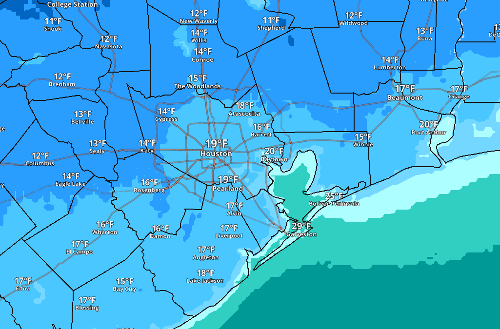
Freezing rain and sleet reported over portions of the area overnight
Freezing rain and sleet reported over portions of the area overnight Hard freezes remain likely tonight and Monday night Dangerously cold wind chills Monday AM Any remaining water will freeze tonight even on ground surfaces Freezing line has been slow to move...
Houston, TX – sidebar
Houston, US
3:43 pm,
Jun 5, 2026
moderate rain