
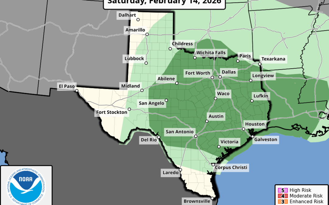
- Widespread showers and thunderstorms are likely
- A few of the storms could become strong or severe in the late afternoon/evening
An upper level trough a weak front will move across Texas on Saturday. Ahead of this feature an influx of Gulf moisture will surge into the region today into Saturday while wind fields aloft increase. Lift will increase on Saturday as early as daybreak with scattered showers spreading northward out of the coastal areas throughout the day. By late afternoon stronger forcing will arrive along the leading edge of the weak front and expect a line of showers and thunderstorms to develop west of the area and move across the area during the late afternoon and evening hours. Timing for the metro area will be between 600pm-1100pm.
While field fields will support severe weather on Saturday, the main question is the amount of instability which currently looks meager. This is a cold pool aloft that swings toward the region from SW TX toward the late afternoon hours and with surface temperatures in the low 70’s might help yield enough instability for a few strong or severe storms. SPC has maintained the “marginal” risk of isolated severe storms (level 1 out of 5) for Saturday with all severe modes being possible.
Storm system will be east of the area on Sunday although some wrap around clouds may arrive from the north. A significant warming trend into next week with potential highs pushing the mid 80’s and lows in the 60’s.