Heavy Rainfall Update (6-12-25 300am)
Heavy rainfall event underway over the region Numerous clusters of thunderstorms producing heavy rainfall developing along and west of I-45. Flash Flood Watch has been expanded to all counties. Increasing lift spreading across a very moist air mass has resulted in the...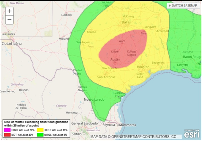
Heavy Rainfall Threat (6-11-25) PM
Heavy rainfall and flash flooding possible tonight into Thursday mainly northwest of the Houston metro area Monitor heavy rainfall trends tonight into early Thursday for any shifts southward in the forecast A complex forecast for tonight into early Thursday as...Active Weather (June 9, 25)
Stretch of active weather for the area through much of this week. While severe thunderstorm chances are low they are not zero. Heavy rainfall possible each day. Mid level high pressure that brought the hot and dry conditions since last Friday has...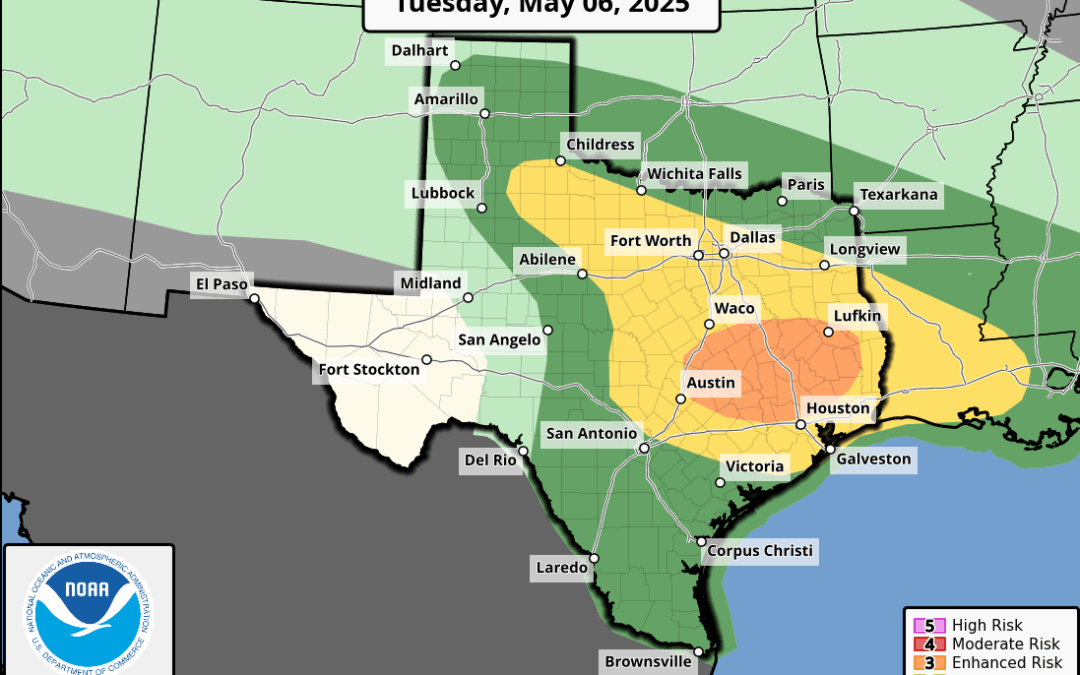
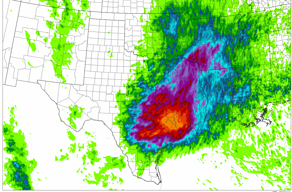
Severe Weather and Flash Flood Threat (5.6.25)
Severe thunderstorms including tornadoes will be possible today mainly north of I-10 Flash flooding also possible. Another severe weather/flash flooding combo day over the region with the main area of concern north of I-10. Strong upper air storm system over NM will...
Active Weather Returns
Active weather will return to the area as early as this afternoon and tonight. A thunderstorm complex currently along the Red River will build southward through the day and approach SE TX late this afternoon and evening. Latest high resolution guidance runs show this...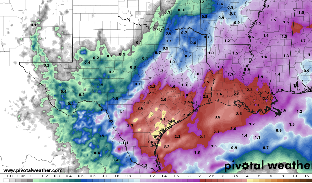
Heavy Rainfall (3-27-25)
Flash Flood Watch has been extended to include Fort Bend and Colorado Counties through Friday evening. Widespread rains…some heavy…likely over the next 24-36 hours. Large upper level storm system over northern MX will move eastward into Texas today and exit the state...
Houston, TX – sidebar
Houston, US
4:33 pm,
Jul 14, 2025
clear sky