
🌦️ WEEKLY WEATHER OUTLOOK | SOUTHEAST TEXAS
📅 November 8–14, 2026
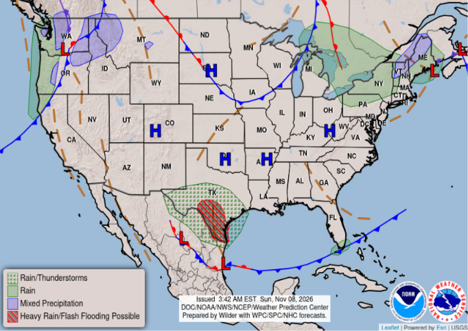
A cloudy and cooler start to the week will eventually give way to a stretch of drier weather across Southeast Texas. Here’s what we’re watching over the next several days.
🌧️ SUNDAY–MONDAY:
Cloudy skies will dominate with scattered light to occasionally moderate showers possible. Rain chances will be highest west and southwest of the Houston metro, although a few showers could develop farther east. Temperatures will remain on the cool side, with highs generally in the upper 60s to lower 70s.
🌥️ TUESDAY:
Clouds will linger with a few additional showers possible. Rain chances should begin decreasing as the upper-level disturbance moves east of the region. High temperatures will reach the lower to middle 70s.
🌤️ WEDNESDAY:
A transition toward drier weather is expected. Clouds should gradually break with more sunshine returning. A cold front will approach and move through Southeast Texas late Wednesday into early Thursday.
☀️ THURSDAY–SATURDAY:
The second half of the week looks much drier and more comfortable. Expect plenty of sunshine, lower humidity, and cooler mornings behind the front. Afternoon temperatures will generally range from the upper 60s to middle 70s, with overnight lows dropping into the 40s and 50s.
THE BIG PICTURE:
- Scattered rain chances to start the week.
- Improving conditions by midweek.
- Cold front expected late Wednesday into early Thursday.
- Drier and cooler weather to finish the week.
Overall, a fairly typical November weather pattern is shaping up for Southeast Texas, with a wet start followed by a beautiful second half of the week.
We’ll continue monitoring the timing of the cold front and any changes in rain chances. Stay with Weather Insights for the latest updates!
#WeatherInsights #HoustonWeather #SoutheastTexas #WeeklyWeather #TexasWeather
Podcast: Play in new window | Download