
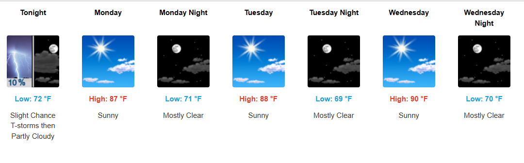
A noticeable weather shift is coming this week! 🌬️ After a wet start to October, drier air moves in, bringing more sunshine, lower humidity, and cooler mornings across Southeast Texas.
🌧️ Sunday: Showers & thunderstorms remain possible, especially early and afternoon. Highs near 82–84°.
☀️ Monday–Wednesday: The best stretch of the week! Mostly sunny to sunny skies, with highs climbing into the mid/upper 80s to around 90°. Overnight lows dip into the upper 60s to low 70s.
🌦️ Thursday–Saturday: Gulf moisture gradually returns, bringing increasing rain and storm chances. Expect highs in the mid-to-upper 80s, with scattered showers and thunderstorms possible.
💡 Weather Insight: The big story is the transition from a wet, humid pattern to a drier and more comfortable air mass early in the week, followed by moisture building back in toward the weekend.
📌 Bottom line: Enjoy the sunshine and lower humidity Monday through Wednesday, but keep the umbrella handy as we head toward the weekend!
#SoutheastTexas #TexasWeather #HoustonWeather #BeaumontWeather #PortArthur #GoldenTriangle #WeatherOutlook #WeeklyForecast #WeatherInsights #TexasForecast #GulfCoastWeather #FallWeather #OctoberWeather
Podcast: Play in new window | Download