Devastating hurricane event likely for the west coast of FL Wednesday.
Hurricane and storm surge watches have been issued for much of the FL west coast with tropical storm watches for the FL Keys.
Discussion:
A NOAA aircraft has just reached the center of Milton and found the pressure has fallen to 954mb and winds are now sustained at 120mph making Milton a category 3 hurricane. Milton has a small eye with a core of deep convection and has been intensifying at a significant rate since yesterday morning IR Satellite Loop for Gulf of Mexico | Tropical Tidbits . The hurricane is moving south of due east along the southern edge of a trough overt eh central and northern Gulf of Mexico.
Track:
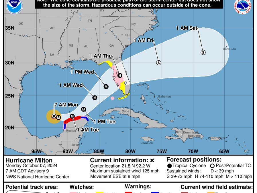
The forecast track reasoning remains unchanged with Milton moving ESE to E over the next 24-36 hours south of a trough over the northern Gulf of Mexico. After 36 hours a new trough will dig into the western Gulf of Mexico and turn Milton toward the ENE or NE…how sharp of a turn will determine where along the FL west coast Milton makes landfall. The GFS and several of the regional hurricane models continue to show a track near or north of Tampa Bay while the majority of the rest of the guidance is south of Tampa Bay. The NHC forecast is very near the multi-model consensus with a landfall just south of Tampa Bay…it should be noted that track errors at this range are nearly 100 miles and Milton is expected to undergo significant wind field expansion over the eastern Gulf of Mexico which will bring wide ranging impacts to a large area.
Intensity:
There is little to stop the bottom from falling out today and Tuesday and Milton will likely become a powerful high end hurricane…possibly reaching category 5 intensity. Milton is over extreme warm sea surface temperatures with a favorable moisture profile and good outflow winds aloft. The small diameter eye will continue to support the quick rate of deepening. The only issue on intensity is if Milton moves a bit further SE than expected and grazes the northern coast of the Yucatan which would likely result in some weakening…but also broaden the wind field.
As Milton approaches the west coast of FL on Wednesday upper level wind shear and dry air over the central Gulf of Mexico look to begin to impact the hurricane leading to weakening however the damage is likely already done in this scenario and Milton is likely to make landfall as a major hurricane.
Impacts:
Storm surge
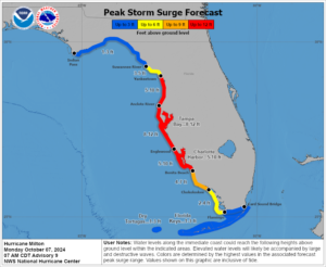
Catastrophic storm surge event is increasingly likely for the west FL coast near and south of where the center moves inland. Values of up to 12 ft above normal dry ground along with large waves are likely and these values will likely need to be raised some. Storm surge will extend far southward from the landfall area into SW FL. A large portion of the FL west coast will experience life threatening storm surge.
Unlike Helene, this portion of the FL west coast is highly populated and similar to Ian (2022) the potential for loss of life is high if people do not evacuate.
Wind
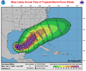
Hurricane conditions are likely across the central part of FL including Tampa, Orlando, and the Space coast Wed/Th as Milton moves across the state. The strongest core of winds will be dependent on the track, but locations near/along I-4 look to receive the highest winds per the latest track. As mentioned the wind field will be expanding which will bring impacts to a large area and well inland. Wind gusts of 80-100mph will be possible along the FL east coast north of where the center exits the coast (This will be onshore wind in this area, opposite of the west coast of FL).
Rainfall
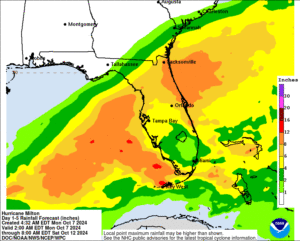
Rainfall amounts of 8-12 inches will possible along the track of Milton on top of saturated ground from recent rains and Helene two weeks ago. Inland freshwater flooding will be likely along the track of the hurricane and likely enhanced by the nearby trough interaction.


