
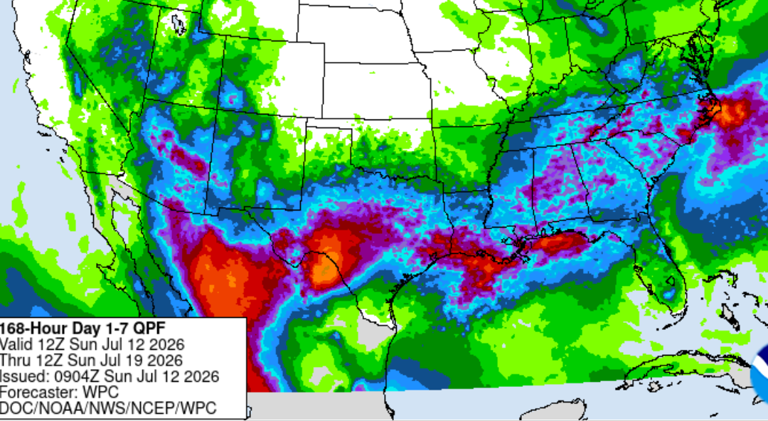
After a stretch of hot and relatively dry weather across Southeast Texas, the forecast is taking a noticeable turn toward a much wetter pattern. Beginning Sunday through midweek—rain and thunderstorm chances will increase as tropical moisture returns to the region.
Tropical Moisture Moving In
Weak high pressure currently over Southeast Texas will gradually shift westward, allowing a trough over the southern Gulf of Mexico to move closer to the Texas coast. A deep plume of tropical moisture is expected to arrive Friday and remain in place through the weekend, creating a favorable environment for scattered to numerous showers and thunderstorms.
By the weekend, showers and thunderstorms are expected to develop earlier in the day as the atmosphere becomes increasingly tropical, requiring very little daytime heating to produce storms.
Active Pattern Continues Into Next Week
The unsettled weather pattern is expected to persist into early next week. Strong high pressure building across the northern United States will steer a weak frontal boundary southward toward Texas while disturbances move westward in an easterly flow aloft. Combined with abundant tropical moisture, these features will keep daily opportunities for showers and thunderstorms in the forecast through at least Tuesday.
Heavy Rainfall Threat
While widespread flooding is not anticipated at this time, some locations could experience isolated episodes of excessive rainfall. Slow-moving thunderstorms in the tropical air mass may produce rainfall rates of 2 to 3 inches per hour, which can quickly overwhelm drainage systems and lead to localized street flooding or ponding of water.
The greatest risk will occur where storms repeatedly move over the same locations.
Residents should also be prepared for:
- Frequent cloud-to-ground lightning
- Brief gusty winds in stronger thunderstorms
- Reduced visibility during heavy rainfall
- Minor travel impacts in areas receiving repeated downpours
Stay Weather Aware
Forecast confidence is high that Southeast Texas will experience a wetter weather pattern through the weekend and into next week. While not everyone will see heavy rainfall, any stronger thunderstorm will have the potential to produce intense rainfall over a short period of time.
Continue monitoring the latest forecasts, especially if you have outdoor plans or travel scheduled. Conditions can change quickly in a tropical weather pattern.
Stay tuned to Weather Insights for the latest forecast updates and rainfall trends.
#WeatherInsights #SoutheastTexas #HoustonWeather #TexasWeather #TXwx #HeavyRain #FloodSafety #TropicalMoisture #StayWeatherAware #WeekendWeather