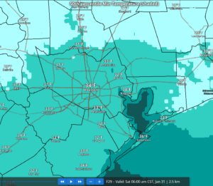
- Hard Freeze Watch in effect for much of the region for Sunday morning for low below 24.
- No winter precipitation
Initial cold front is through the region, but secondary push of colder arctic air will arrive later today/this evening and temperatures will fall into the 40’s and 30’s behind this front and then near or below freezing for much of the area Saturday morning. Gusty winds of 10-15mph tonight will result in wind chills in the upper 10’s north and west to the low to mid 20’s metro area and south and east. Mid and high clouds today will gradually clear tonight.
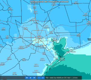
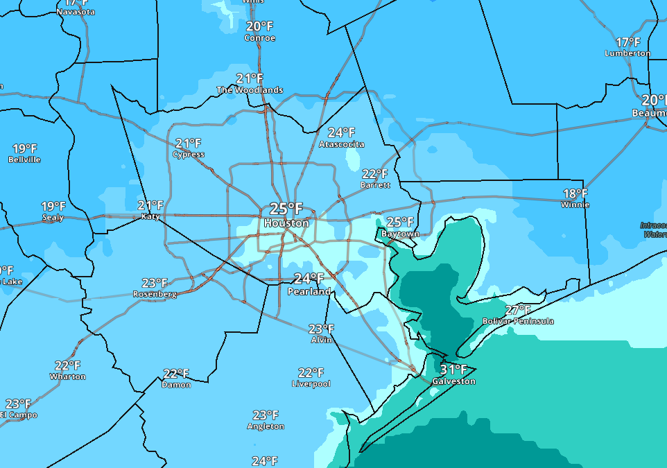
Coldest morning will be Sunday with a widespread hard freeze across much of the region. Lows in the upper 10’s to low 20’s north and west and mid 20’s metro area and south and east. Winds will be near calm Saturday night and Sunday morning so wind chills will be near the air temperature.
High pressure will move eastward starting Sunday with winds becoming southerly and a warming trend into early next week with a possible return of rain chances by Tuesday.