- Another storm system will move across the region Saturday into early Sunday
- A low end severe and heavy rainfall threat is possible from Saturday afternoon to early Sunday morning
- Much colder air mass to follow into early next week
Active weather pattern continues with storm systems crossing the area roughly every 3-4 days. Next system is incoming from the western US and will arrive over Texas on Saturday. Winds have already become easterly this morning and will increase and turn more southeast through the day helping to bring increasing moisture into the area. Clouds will increase from west to east and can’t rule out a few showers west of the Brazos River by this evening, although this looks isolated at best. Better and deeper surge of moisture and modest lift increase into Saturday morning and scattered showers will develop from mid to late morning into the afternoon hours with increasing intensity and coverage. High resolution guidance is showing thunderstorms developing late Saturday afternoon/evening over the northwest portions of the area that then move southeast toward the coast overnight Saturday into Sunday morning.
Severe Threat:
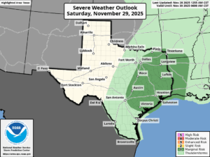
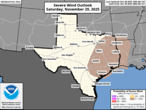
There will be a low end “marginal” (level 1 out of 5) threat for thunderstorms to produce winds at or above 60mph and hail larger than 1 inch in diameter (the requirements for a severe thunderstorm). An isolated tornado will also be possible especially with any cells out ahead of the strong cold front Saturday afternoon/evening. The severe threat is somewhat reliant on the amount of instability that can be built over the area during the day on Saturday…at this time there looks to be enough heating to have just enough instability that a couple of the thunderstorms could become severe.
Heavy Rainfall:
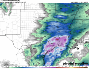
Moisture levels creep up on Saturday into Saturday evening ahead of the strong cold front and thunderstorms that develop may produce brief periods of heavy rainfall. Currently expecting totals of 1-2 inches for most areas and decent storm motions and progressive nature of the system should mitigate any higher totals or flood threat. A few isolated instances of street flooding will be possible under the stronger storms.


