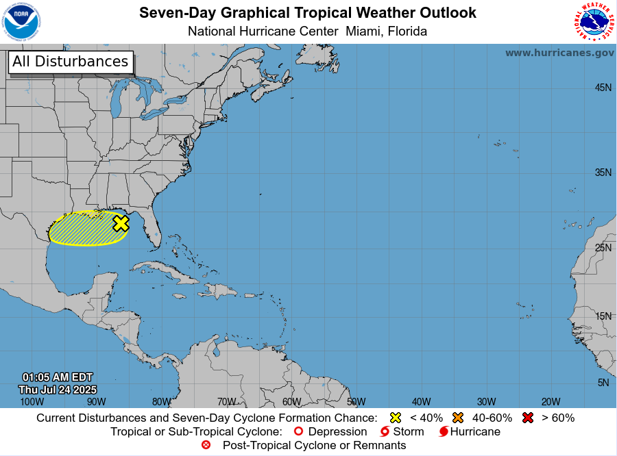
- Little to no tropical development expected with trough of low pressure over the northern Gulf
- Increased rain chances Friday-Saturday
A trough of low pressure over the northeast Gulf will move westward over the next 24-48 hours. While conditions will be marginally favorable for some low end tropical development (depression) the current disorganization of the system along with northeasterly wind shear and lack of time over the Gulf waters look to preclude any significant organization. NHC continues to maintain a low end (10%) chance that a tropical depression could development before the system moves inland over the upper TX coast late Friday into Saturday.
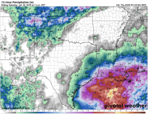
A surge of tropical moisture will begin to arrive along the upper TX coast later today and Friday with widespread showers and thunderstorms likely, especially along the coast and offshore. Guidance has continued the trend of keeping the majority of the activity across the coastal waters with some bands and clusters moving inland at times throughout Friday and Saturday. Some of this activity will produce brief heavy rainfall, but overall rainfall totals currently look to be generally less than an inch for most locations and maybe 1-2 inches along the coast.