- Increasing rain chances locally late Thurs-Sat
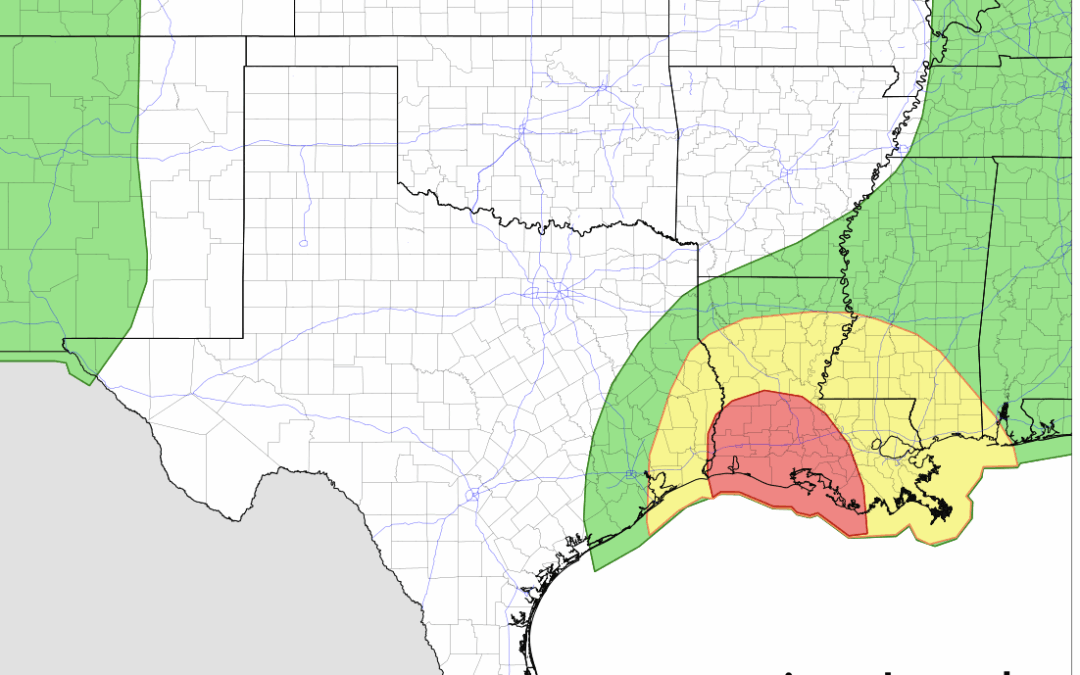
93L this morning is located near Tallahassee FL which is a good bit further north than expected a day or two ago. This northward adjustment in the position of the surface low over land is preventing any sustained development potential in the near term. It is possible the broad surface low does move over the extreme northern Gulf in the next day or so allowing a brief opportunity for some slight development into a tropical depression before making landfall along the southeastern Louisiana coast. It is also possible that this feature remains over land while moving westward and does not develop into an organized tropical system.
As 93L moves westward and then begins to turn northward over Louisiana, a large area of tropical moisture currently over the north and northeast Gulf will move westward and arrive in SE TX late Thursday into Friday. Rain chances will increase and there will be a threat of heavy rainfall especially if any organized banding develops over our area on the west side of the broad circulation. A slight risk of excessive rainfall has been brought a bit further west toward the I-45 corridor for Friday and Friday night. Our area will be on the west edge of some of the higher rainfall totals associated with this system and there is likely to be a sharp gradient in rainfall amounts across the area (drier west and wetter east).
