- Another storm system will impact the area Monday afternoon-Tuesday
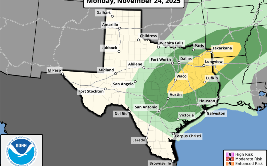
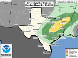
- A low end chance of strong to severe thunderstorms
Weak cool front has pushed into the Gulf waters with a much drier air mass in place over the region. However, this front is starting to begin a northward track as a warm front. Muggy air mass with dewpoints in the low to mid 70’s resides south of this front across the southern coastal bend and south Texas and this air mass will return northward tonight into Monday ahead of the next storm system to move out of the SW US. This next storm system will follow a similar track as the last (Thursday and Friday) with the main dynamics and highest severe/heavy rainfall axis to our north over north Texas.
Warm front should clear much of the area by midday Monday with increasingly favorable parameters for showers and thunderstorms by Monday afternoon into Monday night. High resolution guidance shows a few storms may attempt to develop Monday afternoon in the open warm sector ahead of the main frontal activity Monday evening/night. The strongest lift will arrive Monday evening into Monday night and instability will be somewhat lacking by this time so expect a line of showers and thunderstorms with maybe a strong storm or two. As mentioned the higher severe threat will be found north of the metro area, but the Storm Prediction Center does have the entire region outlooked in a level 1 out of 5 threat for severe thunderstorms Monday evening/night.
Front will slow into the area late Monday into Tuesday with rain chances lingering near the coast on Tuesday before a stronger push of colder and drier air arrives early Wednesday morning.
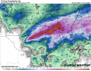
Rainfall amounts will be generally less than an inch for most locations, but any repeat cell training could result in a quick 1-3 inches of rainfall…similar to what we saw late Friday and early Saturday. With grounds still mostly dry from the ongoing drought this will be welcomed and much needed additional rainfall.
Thanksgiving Day:
Thanksgiving Day will feature cool and dry weather for the area with lows in the 40’s and highs in the 60’s under mostly sunny skies
