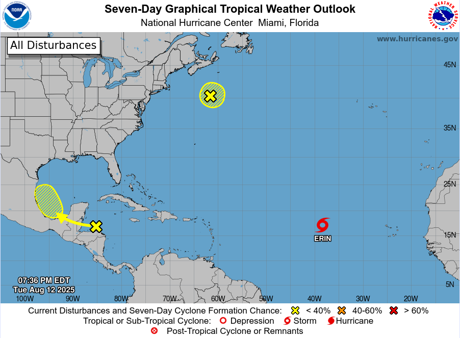
Active tropical wave axis over the western/southwest Caribbean Sea with now low development chances (20%) in the southwest Gulf late this week IR Satellite Loop for Western Atlantic | Tropical Tidbits .
A large mass of thunderstorms earlier this afternoon off the coast of Honduras has been generally weakening this evening, and while there does not appear to be any sort of surface low formation in association with this activity, there may be some mid level spin that has been generated. Upper level outflow is excellent over this feature and will see tonight how any additional thunderstorms may evolve which could help to force lowering surface pressures.
This wave axis will move WNW to NW toward the Yucatan over the next 24-36 hours and then into the southern Gulf Thursday and the western Gulf by Friday/Saturday. Conditions are generally favorable for some slow development of this feature over the Gulf on Thursday and Friday as it nears the eastern Mexican coast although a short time window over the Gulf will likely preclude any significant development. There has been a recent uptick in the ECMWF ensemble members showing development chances in this area today into the 40-60% range, although the ECWMF ensembles have been a bit aggressive on development chances this season thus far.
Tropical moisture is likely to increase along the TX coast into Friday as this feature approaches to eastern MX coast. Depending on the structure of this system by late week will determine rain chances across the upper TX coast with a more broad and disorganized system likely spreading moisture across the area.
Given it is August it is good practice to check the tropics and weather forecasts daily for any changes.
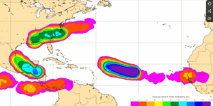
ECMWF development chances of at least a tropical depression
