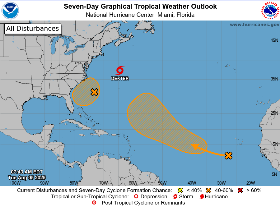
Dexter:
Tropical Storm Dexter is located over the northwest Atlantic 345 miles north of Bermuda this morning and moving to the northeast at 12mph. Dexter continues to undergo strong southwesterly vertical wind shear which is pushing the formation of thunderstorms to the east and northeast of the low level center which has at times been exposed to the west of the deeper convection. The tropical storm has winds of 40mph and given the wind shear and cooler waters the tropical storm will begin to transition into an extra-tropical system over the next 24-36 hours.
Off the Southeast US Coast:
A weak surface trough located off the southeast US coast in association with a decaying frontal boundary that helped to spawn Dexter a few days ago looks to develop a weak area of surface low pressure later this week. The National Hurricane Center has raised the probabilities of tropical cyclone formation in this area to 40% over the next 7 days. A slow westward motion is expected with a gradual turn toward the northwest and north this weekend. Interest along the southeast US coast from northeast Florida to the Carolinas should monitor the progress of this system.
Tropical Atlantic:
A tropical wave exiting the African coast will move west to west-northwest over the open Atlantic where conditions will be marginally favorable for some development. Guidance support for this wave has been wavering up and down over the last few days and it is possible that continued stability issues over the tropical Atlantic may prevent much organization of this feature until further west. Guidance has also been struggling with which wave attempts to develop and at what latitude. For now, this wave or the waves behind it are no immediate threat to any land areas and development is likely to be slow. The National Hurricane Center gives this wave a 50% chance of development over the next 7 days.
