- Low end chance of tropical development in the north and northwest Gulf late this week.
- Increasing rain chances locally Friday and Saturday.
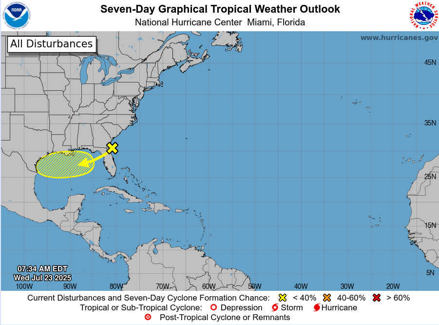
In a pattern similar to last week, another trough of low pressure on the tail end of a decaying frontal boundary off the SE US coast is starting to move westward this morning approaching the Florida northeast coast. This feature will continue west and west-southwest and into the Gulf over the next few days. While upper level winds are generally a bit unfavorable currently out of the northeast, as the system moves south of Louisiana late Thursday into Friday conditions look to become more favorable for some development. Main question is where any surface low may form and similar to 93L last week…how much land interaction occurs if any. The ECMWF tropical cyclone formation probabilities of a least of tropical depression have increased in the last 24 hours in the area off the southern Louisiana and upper TX coasts. NHC current has development chances at a low (10%), but it would not be completely surprising if something weak tries to organize near the coast on Friday or Saturday.
Regardless of any development, rain chances will quickly increase on Friday as a pool of tropical moisture associated with this feature moves into the southeast Texas coast. Rainc hances will remain elevated Friday night into Saturday with periods of showers and thunderstorms and squalls moving over the region. How much rainfall along with where the greatest rains will occur is uncertain. This is potentially a situation where the heaviest rainfall could remain near the coast or offshore. Additionally, any development of a surface low pressure center would tend to focus the rainfall in that area and it is possible this could happen just to our east with much of the area on the “drier” side of any circulation.
It would be a good idea to monitor weather forecast daily for any changes.
