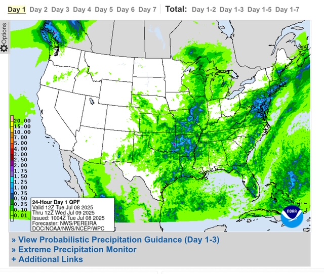
- Drier weather for central Texas and the Hill Country
- Wet weather pattern develops over SE TX through much of the week
For the first time in a days the radars over central Texas and the Hill Country are showing no showers and thunderstorms this morning. Additionally, there have not been any significant rainfall bombs since Saturday. The mid level trough axis responsible for the recent flooding is slowly being replaced with increased levels of ridging (high pressure), but this high is not overly strong and a weakness will generally be found over Texas through much of this week.
While the threat for heavy to excessive rainfall is significantly reduced, chances for showers and thunderstorms (mainly in the afternoon and evening hours) will be maintained, but this activity is not likely to anchor or cluster as what happened last Thursday and Friday nights. Rain chances may increase again toward the weekend as the weakness becomes more pronounced and a trough digs into the area. Will have to keep an eye on this along with moisture levels to see if any return of more concentrated heavy rains will be possible. As mentioned before, once these summer patterns become established they are hard to break.
Locally, a westward moving upper level low (non-tropical) across the NW Gulf will bring enhanced lift and moisture to SE TX today through mid week with increased chances for showers and thunderstorms especially along the daily inland moving sea breeze front. Some of these thunderstorms will be capable of producing brief heavy rainfall which may lead to isolated instances of street flooding, but no sustained widespread flooding is expected.
General wet pattern will continue into the end of the week although rain chances may trend down some Friday before coming back up this weekend.
This will be the final update on the TX flooding as the event has transitioned away from the weather aspect and ongoing river and creek flooding is at minor levels or below.


