- No new flash flooding overnight
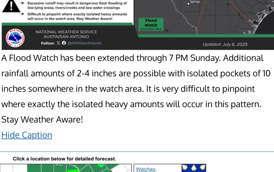
- Weather pattern remains in place today into Monday for additional heavy rainfall and flash flooding
- Persons should continue to be mindful of the weather conditions while visiting, camping, and vacationing in this area through tomorrow.
The good news is that thus far there has been no new heavy rainfall and flash flooding, but recent radar trends west of I-35 suggest an increase in activity including pockets of heavy rainfall. Guidance continues to indicate the potential for additional isolated areas of excessive rainfall today, tonight, and into Monday over portions of the Hill Country and central Texas as the slow moving/stalled mid level trough axis/weakness aloft remains over this area combined with tropical moisture.
As mentioned before, the where, when, and how much are the key questions in this type of setup and we are at the limit of the science on these answers usually until the storms begin to evolve. Where the heavy rain falls can quickly result in flash flooding on normally dry creeks and rivers…in some cases the water can rise feet in minutes yielding little time for action. Persons in vulnerable locations along dry or low flowing creeks and rivers must keep abreast of water levels and conditions and be prepared to react quickly.
Rivers:
Floodwaves have terminated into the various lakes in central Texas (Lakes Travis, Buchannan, and Canyon). These lakes remain well below normal conservation pools due to the long term drought in this area and will be able to fully absorb these flood flows with no downstream impacts or flood gates releases.
It should be noted that higher than normal flows are occurring at several points in the Highland Lakes chain and significant debris has been washed into the various lakes in the last 48 hours making boating and recreational use hazardous at times.
Rainfall below the control structures yesterday will result in rises on the Colorado River at Bastrop and Smithville today and the Guadalupe River downstream through Victoria this week. Based on current flows and forecasts no flooding is expected, but flows along the river will be elevated and normally dry low land areas will be inundated.
Local:
Rain chances will begin to increase over our local area into early this week in association of an upper level low that will approach from the northeast Gulf. This will usher in more favorable conditions for afternoon showers and thunderstorms along the seabreeze. Heavy rainfall will be possible as is typical in such summer situations with some isolated instances of street flooding through mid week.
High pressure will attempt to build into the region later this week and lower rain chances, but how fast this happens is in question and thus far this summer significant high pressure has been unable to gain a strong foothold over the state or region and completely shut off rain chances. Summer patterns are hard to break once they become established given generally weak flow in the atmosphere this time of year.
Jeff Lindner
