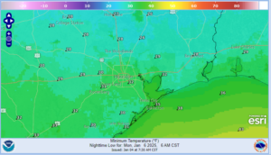
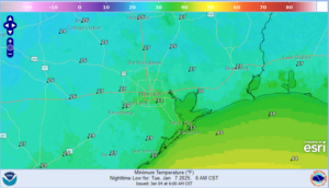
Arctic front will move across the area tomorrow afternoon with significantly colder temperatures for much of this week.
Preparations for daily freezes should be completed by Sunday afternoon.
Arctic frontal boundary over the Dakotas will surge southward later today into Sunday as a strong winter storm develops over the plains and OH valley this week. Current temperatures in southern Canada range from -13 to -34 north of the US border. Boundary will reach north Texas around sunrise on Sunday and move quickly southward and off the upper TX coast by late afternoon/sunset. Temperatures ahead of the front will reach into the upper 70’s over much of the area before the bottom falls out Sunday night. Temperatures will fall 15-20 degrees immediately with the frontal passage and then continue downward into the 40’s Sunday evening and the 30’s by Monday morning. Freeze line will quickly advance into the region and reach near I-10 by sunrise Monday. Strong northerly winds of 20-30mph will drive wind chills into the 10’s and 20’s by Monday morning with actual air temperatures some 35-45 degrees colder than Sunday afternoon. Temperatures will struggle to warm on Monday with highs only reaching to low to mid 40’s over much of the area as strong cold air transport continues into the area. Tuesday morning looks to be the coldest with lows in the mid 20’s north of HWY 105, upper 20’s along and north of I-10 and low 30’s down to the coast. Duration of the sub-freezing temperatures will range from 9-13 hours north of HWY 105 to 6-9 hours along and north of I-10 to 3-6 hours along the coast. Will need to keep an eye on the higher resolution guidance which is now starting to come into range of this time period for any needed adjustments to the low temperatures.
This will not be a long duration sub-freezing event nor to the level of cold of recent freezes in the last few years.
Preparations:
Now is time to complete cold weather winterization precautions.
- Protect sensitive vegetation.
- Protect any exposed outdoor pipes (sprinkler systems should be shut off and properly drained).
- Prepare proper shelter and warmth for pets and livestock.
- Persons should limit outside exposure to a minimum.
The advective nature of the sub-freezing temperatures Sunday night/Monday morning will be particularly damaging to exposed sensitive vegetation as the typical covering “greenhouse” method will only offer limited protection against the strong winds that will accompany the incoming cold air.
Severe Weather:
While there remains a low end severe weather threat along and ahead of the frontal boundary on Sunday afternoon this threat appears to be focused more to the east and northeast of the local area. Cannot rule out a damaging wind gust, but it appears the surging cold air mass will undercut developing showers and thunderstorms and this usually mitigates the severe weather potential. The Storm Prediction Center has maintained the “marginal” and “slight” (levels 1 and 2 out of 5) for the area.
Winter Precipitation Potential:
The incoming air mass will be dry and cold with dewpoints falling into the 10’s and 20’s over much of the area Monday/Tuesday. While this air mass is in place, a large upper level low will be located over the Baja region of MX which is a favorable position for energy to eject disturbances and moisture from the Pacific into the cold air mass entrenched over TX. Guidance and their respective ensembles are starting to come into some slightly better agreement that the Baja low will begin to move toward and across TX in the Wed-Fri period. At that time a coastal low pressure system will form over the western Gulf of Mexico and help to push deeper amounts of moisture northward into the cold air mass. There remains considerable uncertainty on how much the cold air mass will modify into the late week period and what the temperature profiles look like over the area to determine what type of precipitation may fall. Recent trends have been for slightly warmer profiles locally which would tend to favor any freezing/frozen precipitation more to the north and northwest of the local area across central and north Texas, but only a few degrees could change this outcome. Will have to continue to monitor this period closely for trend and any possible impacts.


