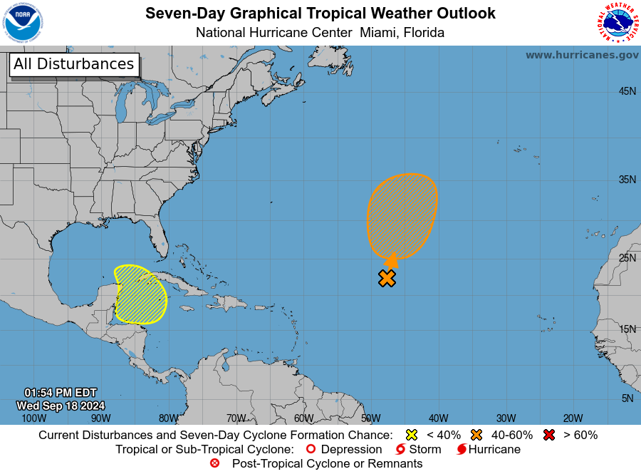
Atlantic tropics remain quiet currently and likely for the next few days although a tropical system may attempt to develop along an old frontal boundary over the central tropical Atlantic as moisture and energy from the remains of Tropical Storm Gordon interact with this feature.
Attention will generally shift to the western part of the basin…specifically the western Caribbean Sea as guidance continues to indicate the potential for tropical storm formation early to mid next week in this region. This will likely be a result of a broad Central American Gyre (CAG) which is common in this area this time of year. Spokes of energy rotate around the larger elongated trough of lower pressure over central America (CAG). As such tropical development becomes increasingly likely in the western Caribbean Sea, Bay of Campeche, or off the southern coast of Mexico. Guidance continues the recent trend of showing lowering pressures in the western Caribbean Sea as early as late this weekend into early next week. There is decent ensemble support from both the GFS and ECMWF although there is large spread in the ultimate track solutions which is not uncommon in such situations where the local evolution of any surface low can be tricky and uncertain until it forms.
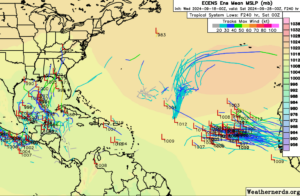
ECMWF Ensembles 00z 9-18
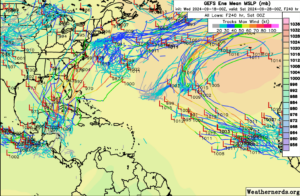
GFS Ensembles 00Z 9-18
Currently the National Hurricane Center indicates there is a 20% chance of development in this area over the next 7 days although it would appear likely that chances will be increasing as confidence increases. While any ultimate track solution is questionable at this time a northward movement toward the Gulf of Mexico by the mid part of next week appears to currently be the more likely path given the upper air and steering pattern over the central and eastern US mid to late next week.
